

Preview
Document Type
Map
Physical Location
G1019 1897 .C46
Contributors
Benjamin E. Smith ; Matthews-Northrup Company
Date of Creation
1897
Publication
New York : The Century Co.
Language
English
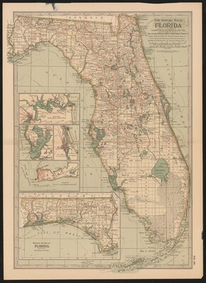
Description
Subject: Salesman's sample page of a map included in the Century Atlas in 1897. A map of Florida with four insets showing the state divided into counties, with major cities, county seats and railroads shown. Inset shows Jacksonville, Tampa Bay, St. Augustine, and Keywest. Shows cities, towns and railroads.
Map Scale
Scale [1:1,710,720]
Part of
Allen Lastinger Center for Florida History
Keywords
Early maps; Georgia -- Maps

Recommended Citation
Century Co. "Florida." New York : The Century Co., 1897. Allen Lastinger Center for Florida History. Thomas G. Carpenter Library, University of North Florida. UNF Digital Commons, https://digitalcommons.unf.edu/alcfh-maps/49