
Allen Lastinger Center for Florida History
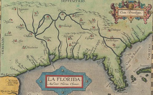
<center>Early Maps of Florida: Maps that influenced how Europeans viewed Florida and the rest of the "New World" from the Allen Lastinger collection</center>
<center>On View August 18, 2025-February 28, 2026</center>
The maps displayed here were modern works in the 16th through 18th centuries, providing Europeans some of the earliest views of what many were calling the “New World.” Looking at these maps in chronological order, we can see how ideas were passed along and expanded upon, coastlines and boundaries were shaped, and European exploration and colonization pushed new boundaries.
These maps did not just serve a cartographic purpose for travelers, they were frequently part of a larger work created both to attract readers and for governments to gather support for their new territorial claims. They were often decorated with depictions of people and creatures rumored to be in these new places, or with historical events, to make them more appealing. We invite you to view these maps both as cartographic achievements of their time and as artistic pieces, created to intrigue and capture the imagination of a new unknown.
Click here to view the digital exhibit.
Visit during our regular hours to view the exhibit in person.
If you would like a transcript of the exhibit, please email us at [email protected].