

Maps Prepared by Simons
Preview
Item Type
Map
Creation Date
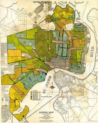
9-9-1930
Description
Zoning map, adopted by ordinance no. U-125, September 9, 1930. In conformity with the comprehensive city plan of Jacksonville, Florida. [Jacksonville, Fla. : Simons?, 1930?] Included in Comprehensive City Plan of Jacksonville, Supplement 1.
View The Comprehensive City Plan of Jacksonville, FL here: http://digitalcommons.unf.edu/simonsflorida/7/