

Preview
Creation Date
10-1-2012
Description
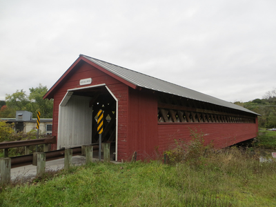
Bennington Falls Covered Bridge 1 Bennington VT Over the Walloomsac River.
National Register of Historic Places
NRIS #73000185
aka Paper Mill Bridge
Latitude, Longitude
42 deg 54' 46.31", 73 deg 14' 3.28"
Recommended Citation
George Lansing Taylor, Jr.
Image Location

Accessibility Statement
This item was created or digitized before April 24, 2027, or is a reproduction of legacy material created before that date. It is preserved in its original, unmodified state specifically for research, reference, or historical recordkeeping. In accordance with the ADA Title II Final Rule, the Library provides accessible versions of archival materials by request. If you are experiencing difficulty accessing the information on the site due to a disability, please submit a request through the following form for assistance.